- Home
- Services
- Utility Mapping
Utility Mapping
Need Utility Mapping or GIS PAS128?
Underground Utility Mapping & PAS 128 Surveys
The greatest risk to any construction or excavation project lies unseen beneath the ground. Unknown high-voltage cables, gas mains, water pipes, and complex sewer networks can cause catastrophic project delays, dangerous utility strikes, and significant budget overruns.
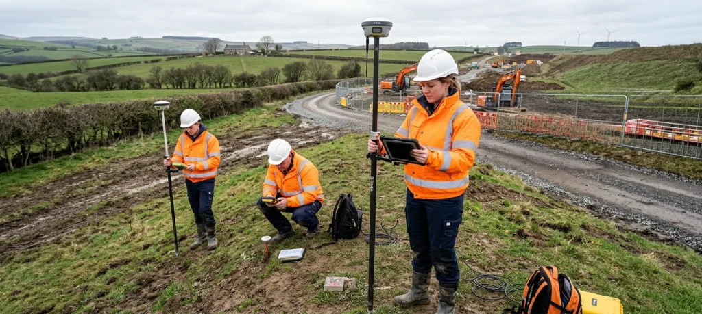
Civil Connect provides highly accurate, full-spectrum underground utility mapping surveys compliant with PAS 128 standards. We locate, trace, and map the precise position and depth of all subsurface utilities, giving your engineering team the critical data needed to design, plan, and excavate with absolute confidence.
Our PAS 128 Utility Detection Technology
We use a multi-disciplinary approach, combining the latest non-intrusive technologies to build a complete and reliable digital twin of your site’s underground infrastructure.
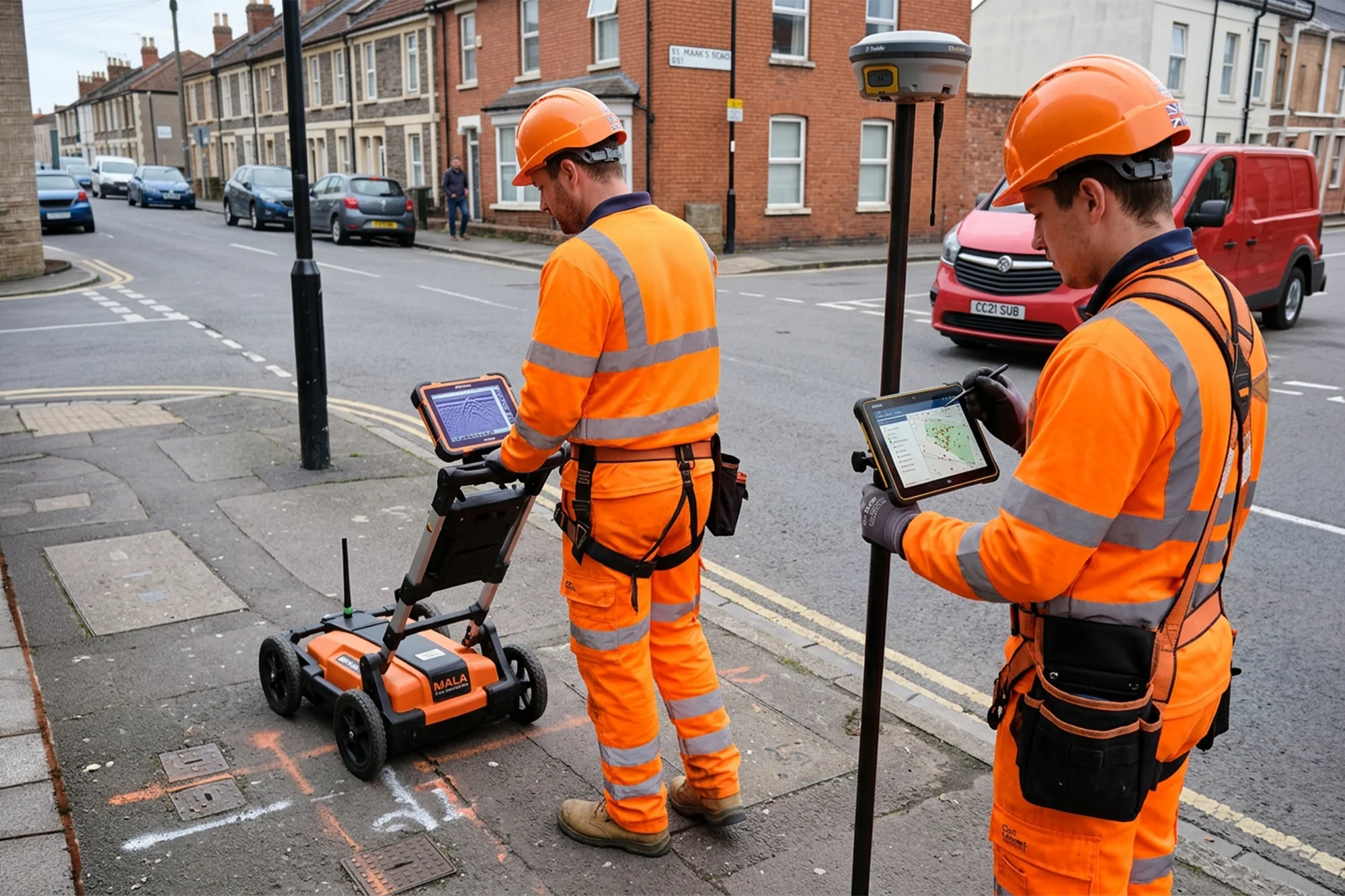
Ground Penetrating Radar (GPR): GPR is essential for locating non-metallic targets such as plastic (PE/PVC) water mains, fibre-optic ducts, clay drainage, and buried concrete structures that electromagnetic tools cannot detect.
Electromagnetic Location (EML): EML is the industry standard for tracing conductive utilities. We actively induce signals to detect and map live electrical cables, ductile iron water mains, and steel gas pipes across your site.
CCTV & Sonde Tracing (Drainage Specialists): As subsurface infrastructure experts, we excel where standard surveyors fail: deep drainage. We deploy robotic CCTV crawlers equipped with multi-frequency sondes to map the exact invert levels, connectivity, and structural condition of complex sewer networks.
GPS & Topographical Integration: All subsurface data is captured using high-precision RTK GPS/GNSS equipment and overlaid onto highly accurate topographical surface surveys.
Our Deliverables: What You Receive
Our goal is to provide clear, clash-free data that integrates directly into your project’s digital workflow. Your final utility survey package will include:
PAS 128 Compliant Data: Delivered to the required Quality Level (QL-D to QL-A) to meet stringent Tier 1 industry and regulatory standards.
Detailed AutoCAD Drawings: Professionally drafted 2D or 3D DWG plans showing the horizontal and vertical alignment of all located utilities.
BIM & GIS Ready: Data formatted for seamless integration into 3D BIM models (Revit) or Geographic Information Systems (GIS) for long-term asset management.
Comprehensive Utility Reports: Detailed documentation highlighting service depths, anomalies, and areas of high risk (such as heavily congested utility corridors).
Sectors & Applications
Our drainage mapping services are critical for a range of clients and projects:
Construction & Development: For pre-design planning and clash detection on new build sites.
Local Authorities & Water Companies: For asset management and updating as-built records of public sewer networks.
Civil Engineering & Infrastructure: To safely plan excavations for new roads, bridges, and utilities.
Environmental Agencies: For mapping culverts and surface water outfalls as part of flood risk assessments.

In-House AutoCAD & Data Processing
Raw survey data is only useful when it is transformed into a clear, actionable plan. At Civil Connect, our in-house CAD and Geospatial team ensures that the precise data collected on-site is delivered in a format that works for your engineers.
Data Integration: We expertly overlay all collected utility data onto your existing site plans or masterplans.
As-Built Verification: We specialise in verifying and updating outdated statutory utility records (Stats), ensuring your design teams are working from the true, current conditions on site—vital for safe CDM (Construction (Design and Management)) compliance.
Why Partner with Civil Connect?
- Specialist Focus on Drainage: We are not generalists; our expertise lies in accurately mapping complex drainage and sewer systems.
- PAS 128 Compliant: All our surveys are conducted to the highest industry standards, giving you verifiable and trustworthy data.
- Environment Agency Registered: We are registered with the Environment Agency, ensuring all our engineers comply with the latest regulations and environmental best practices. Your project is in responsible hands.
- End-to-End Service: From the initial site scan and data collection to the final AutoCAD drawing, we manage the entire process in-house, ensuring quality and accountability.
Map the Unseen. Mitigate Your Risk.
Don’t let an unknown sewer or culvert derail your project. Contact the Civil Connect team today to discuss your site requirements and receive a detailed, no-obligation proposal.
Civil Connect Subsurface is a division within the Civil Connect PLC group of companies.
Registered Office: Cuckoo Wharf, Lichfield Road, Birmingham, England, B6 7SS
Subsurface
Legal & Compliance
Copyright © 2025 All rights reserved. Civil Connect PLC®