- Home
- Services
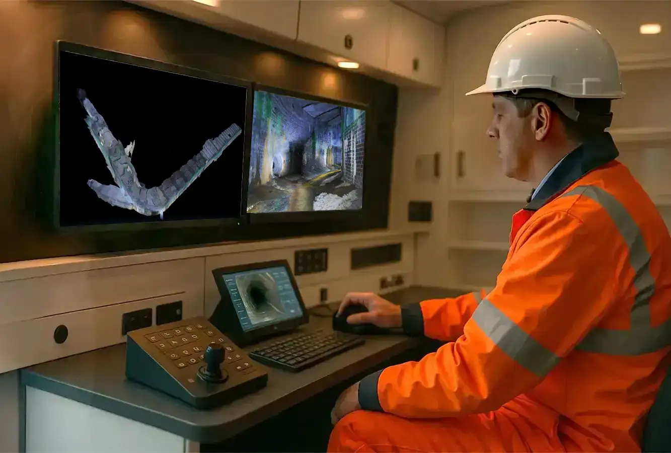
- ROV Inspections
Hydrographic & Bathymetric Surveys
Need a Specialist Hydrographic Survey?
Sectors We Serve
High-Resolution Hydrographic & Bathymetric Mapping
Rivers, canals, reservoirs, and coastal zones are dynamic environments where the unseen underwater landscape is constantly changing. Civil Connect provides Tier 1 hydrographic and bathymetric surveys, delivering a high-resolution, 3D “Digital Twin” of the riverbed or seabed.
We empower asset managers to see below the waterline, identifying critical risks such as bridge scour, siltation, and structural erosion without the need for dangerous diving operations.
Our Hydrographic Survey Services
We deploy a range of advanced acoustic technologies from dedicated survey vessels or Unmanned Surface Vessels (USVs), selected based on your site’s specific depth and access requirements.
Bathymetric Surveys (Multibeam & Singlebeam): The core of our offering is precision bathymetric mapping. We map the topography of the underwater terrain to centimetre-level accuracy.
- Multibeam Echosounder (MBES): Captures a dense “point cloud” of the entire riverbed, revealing subtle features, scour holes, and bedforms in 3D.
- Singlebeam Echosounder (SBES): Efficient for cross-sectional profiling in shallow rivers, canals, or for verifying dredge depths.
Hydrological Survey & Flood Risk: Understanding water flow and capacity is critical for flood modelling. Our hydrological survey data provides the precise riverbed profiles needed to calculate flow rates and flood storage capacity accurately.
Bridge Scour & Asset Inspections: Scour is the leading cause of bridge failure over water. As a specialist bathymetric surveyor, we use high-frequency sonar to inspect the base of piers and abutments.
- Scour Assessment: Quantifying the depth and extent of scour holes that threaten structural stability.
- Asset Condition: Detecting undercutting or damage to retaining walls, outfalls, and aprons.
Siltation & Dredging Support: We provide the bathymetric data needed to maintain navigable waterways and flood capacity.
- Pre & Post Dredge Surveys: Calculating precise cut-and-fill volumes to validate contractor works.
- Silt Profiling: Using Sub-Bottom Profilers (SBP) to determine the depth of soft sediment overlying hard rock.
Why Choose Civil Connect as Your Bathymetric Survey Company?
Inspecting submerged assets presents significant logistical and safety challenges. Unlike general hydrographic survey companies that may lack engineering context, we are civil engineering specialists. We understand that you don’t just need a map; you need to know if your bridge is safe.
Our remote survey solutions provide the actionable data you need to:
Prevent Flooding: Proactively identify silt accumulation that restricts hydraulic flow in rivers.
Protect Critical Infrastructure: Detect erosion around bridge piers before it leads to collapse.
Ensure Navigational Safety: Chart underwater obstructions in ports and marinas.
Maintain Compliance: Generate precise digital records for Environment Agency reporting.
Your Deliverables: Clear, Engineering-Grade Data
We process raw sonar data into clear, usable formats for your engineering teams.
3D Digital Terrain Models (DTM)
Colour-Coded Bathymetric Charts
Cross-Sectional River Profiles
Volumetric Sediment Calculations
GIS & CAD Compatible Files
Applications for Sonar Mapping
Flood Risk Management: Quantifying silt build-up in rivers and reservoirs to inform hydraulic models and flood defence strategies.
Infrastructure & Scour: Inspecting bridge piers, foundations, and outfalls for scour and erosion.
Dredging & Navigation: Providing pre- and post-dredge surveys for ports, harbours, and canals to ensure safe passage.
Asset Location: Locating and identifying submerged pipelines, cables, wrecks, or lost equipment.
Environmental Monitoring: Mapping aquatic habitats and monitoring changes in the riverbed over time.
Get a Clear View of Your Submerged Assets
Stop guessing what lies beneath the surface. Contact the Civil Connect Hydrographic Division to discuss your bathymetric survey cost and project scope. We can help you understand your assets, mitigate risk, and plan your maintenance effectively.

Civil Connect Subsurface is a division within the Civil Connect PLC group of companies.
Registered Office: Cuckoo Wharf, Lichfield Road, Birmingham, England, B6 7SS
Subsurface
Legal & Compliance
Copyright © 2025 All rights reserved. Civil Connect PLC®