- Home
- Services
- Services Detail
Topographical Mapping
Need a Topographical Survey
Projects That Benefit
Precision Topographical Surveys: The Foundation of Asset Intelligence
Moving beyond simple coordinates. Civil Connect delivers BIM-ready terrain models and subsurface data that de-risk your project from day one. Surveyed with precision, backed by PLC accountability.
Address the “Find & Fix” philosophy I mentioned in our research.
Most survey firms provide a map and walk away. At Civil Connect, our topographical data feeds directly into our trenchless repair and civil engineering divisions. We don’t just find the terrain constraints; we provide the engineering intelligence to overcome them
- 3D Laser Scanning & Point Cloud Generation
- UAV (Drone) LiDAR Acquisition for Large-Scale Sites
- Subsurface Integration (Overlaying Utilities on Topo Maps)
- Hydraulic & Riverbed Mapping (Hydrographic Surveys)
Topographical Surveys & BIM Terrain Modelling | Civil Connect
Professional topographical mapping for UK infrastructure. High-accuracy 3D laser scanning & LiDAR integrated with subsurface utility data. De-risk your site with Civil Connect.
Why Choose Civil Connect for Drone Inspections?
CAA Licensed & Insured We are a professional drone survey company. All our pilots are CAA certified (GVC/A2 CofC) and we operate under strict safety cases in congested areas and near critical infrastructure.
Engineering-Grade Data: We don’t just take pretty pictures. We use RTK (Real-Time Kinematic) positioning and Ground Control Points (GCPs) to ensure our topographical surveys are accurate to within centimetres.
Safety First: By using drones, we remove personnel from hazardous environments—whether that is working at height on a fragile roof, or entering a confined space culvert.
Why Tier 1 & Tier 2 Contractors Choose Civil Connect
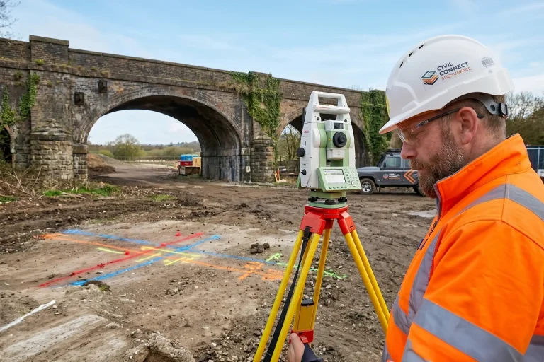
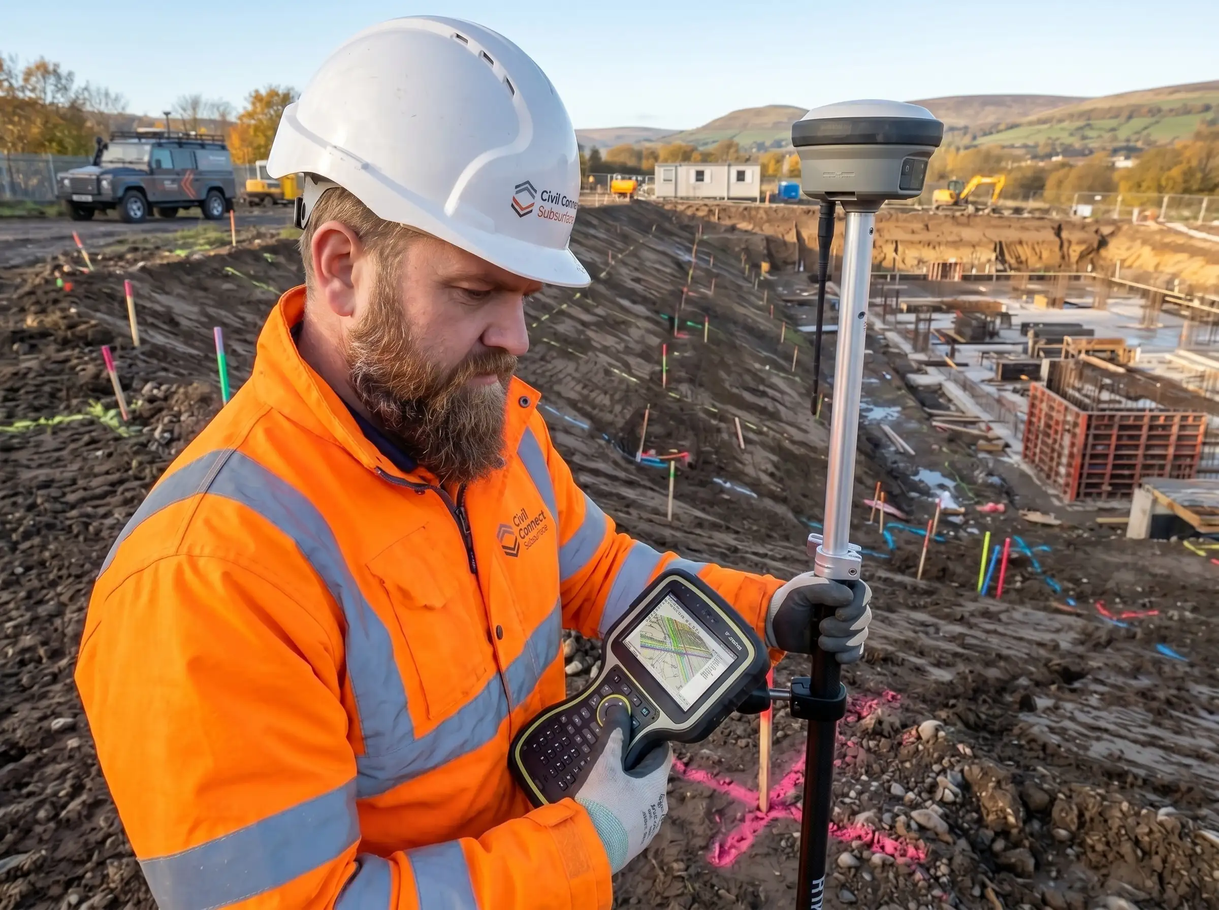
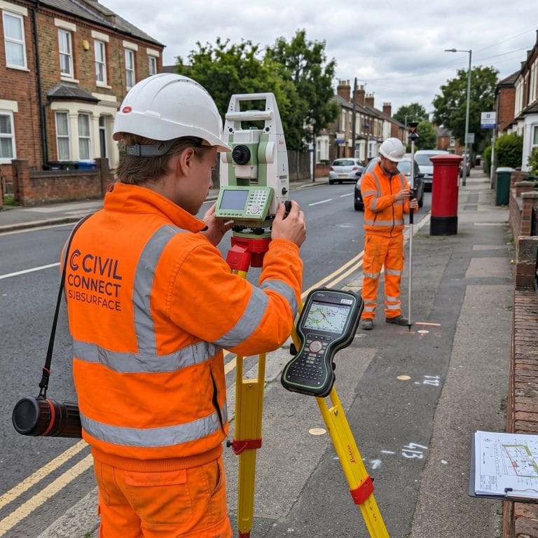
Engineering-Grade Accuracy: We utilise a Tier 1 technology stack—including Leica and Trimble Total Stations alongside RTK GNSS rovers—ensuring our topographical surveys are accurate to within millimetres and fully compliant with RICS specifications.
Seamless CAD & BIM Integration: Your design team needs data they can use immediately. We provide fully layered, cleanly drafted 2D AutoCAD drawings (.DWG), 3D Revit models, and heavy-data Point Clouds (.RCP / .E57) tailored to your exact scope.
Safety & Compliance First: Operating under strict RAMS, our field engineers and CAA-licensed UAV pilots hold all necessary site certifications (CSCS, PTS, confined space), allowing us to work safely on live highways, railways, and active construction sites.
Our Topographical Survey Deliverables
We tailor our outputs to match the specific software and compliance requirements of your architects, civil engineers, and project managers.
Standard & Advanced Outputs Include:
2D Site Plans: Fully layered AutoCAD (.DWG) and PDF formats detailing boundaries, levels, tree canopies, and hard-standing features.
3D Terrain Modelling: Digital Terrain Models (DTM) and Digital Elevation Models (DEM) for accurate cut-and-fill volumetric calculations.
BIM-Ready Point Clouds: Colorized, registered 3D point clouds ready for immediate import into Revit or Navisworks.
Integrated Utility Surveys: Combined topographical and underground utility mapping (GPR/CAT) to provide a complete 3D picture of your site above and below ground.
Sectors We Survey & Support:
Major Infrastructure (Highways, Rail & Utilities)
Large-Scale Commercial & Residential Developments
Earthworks, Volumetric & Cut-and-Fill Operations
Flood Defence & Environmental Planning
Brownfield Regeneration & Landfill Sites
Ready to Instruct a Survey?
Whether you require a standard topographical boundary survey for a planning application, or complex 3D laser scanning for a major infrastructure tender, Civil Connect has the capacity to deliver nationwide.
Partner with a proactive, accountable technical services team. Contact our engineering desk today to discuss your site specifications, request an example DWG file, or get a rapid quote.

Civil Connect Subsurface is a division within the Civil Connect PLC group of companies.
Registered Office: Cuckoo Wharf, Lichfield Road, Birmingham, England, B6 7SS
Subsurface
Legal & Compliance
Copyright © 2025 All rights reserved. Civil Connect PLC®