- Home
- Services
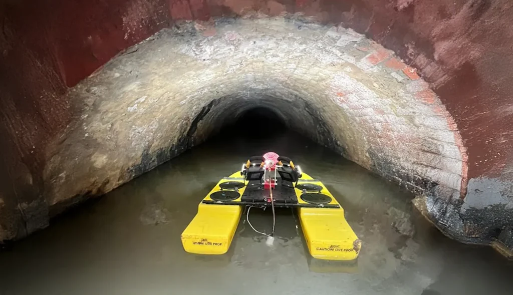
- CCTV Drain Survey
GPR Void Detection, Sinkhole & Structural Scanning
Suspect a Void, Sinkhole, or Concrete Issue?
Advanced Subsurface Risk Mitigation
In civil engineering, the greatest risks are often geological, not utility-based. Civil Connect utilises high-frequency Ground Penetrating Radar (GPR) to provide a non-destructive “X-ray” of the ground and concrete structures.
While our utility teams look for pipes, our forensic GPR teams look for anomalies: voids, sinkholes, changes in ground density, and hidden structural reinforcement. We provide the engineering certainty required to load-bear heavy plant or certify structural integrity.
Our Specialist GPR Survey Capabilities
We separate our forensic GPR services into three distinct engineering disciplines:
Void Detection & Sinkhole Investigation: Sub-surface voids under roads and runways can lead to catastrophic collapse.
Road & Runway Scanning: Rapidly scanning kilometres of pavement to detect voids caused by washed-out fines or leaking sewers.
Sinkhole Analysis: Identifying the extent of ground relaxation or “soft spots” before a sinkhole opens up.
Basement & Cellar Location: Locating unknown historical basements, crypts, or coal chutes under development sites.
Concrete Scanning & Rebar Location Before you drill or cut concrete, you need to know what is inside.
Rebar Mapping: 3D mapping of reinforcement bars, post-tension cables, and mesh within concrete slabs.
Slab Thickness: Verifying concrete depth and construction quality non-destructively.
Flue & Chimney Location: Locating structural flues within walls for refurbishment projects.
Ground Stability & Heavy Lift Verification: Essential for Tier 1 logistics and crane operations.
Crane Pad Surveys: Scanning the ground where crane outriggers will sit to ensure there are no hidden voids or weak zones that could cause the crane to topple.
Backfill Verification: Checking that trenches have been compacted correctly and contain no air pockets that will lead to future subsidence.

Technical Geophysics: Beyond The "Beep"
Standard GPR surveys often just mark targets. We provide geotechnical correlation.
Data Interpretation: Our geophysicists analyse the GPR wave velocity to distinguish between a hollow void, a water-filled pocket, or a dense obstruction.
Targeted Remediation: We don’t just find the void; we help determine if it was caused by a leaking drain (washout) or natural geology, allowing you to fix the root cause.
Why Choose Civil Connect for Structural GPR?
High-Frequency Antennas: We use specialised 2.0GHz+ antennas for concrete and shallow void resolution, offering far greater detail than standard utility mapping units.
Forensic Reporting: We deliver detailed “Radargrams” and cross-sectional slices, giving structural engineers the data they need to sign off on safety cases.
Rapid Mobilisation: We can deploy urgently to investigate potential sinkholes or road collapses.
Why Tier 1s and Councils Partner with Civil Connect
We bridge the gap between complex engineering and field-level execution.
Tier 1 safety culture ensures every job is done correctly the first time, while.
Local Partner mentality keeps us responsive and cost-effective for developers and councils alike.
Don’t let a hidden void undermine your project. Contact the Civil Connect GPR Division to discuss your void detection or concrete scanning requirements.

Civil Connect Subsurface is a division within the Civil Connect PLC group of companies.
Registered Office: Cuckoo Wharf, Lichfield Road, Birmingham, England, B6 7SS
Subsurface
Legal & Compliance
Copyright © 2025 All rights reserved. Civil Connect PLC®