- Home
- About Us
- Underwater Inspection
- Reactive & Onsite Support
- Specialist Surveying
- Civils & Rehabilitation
- Trenchless Rehabilitation (UV CIPP & No-Dig)
- Specialist Culvert Cleaning & De-silting
- Manhole & Joint Rehabilitation
- Retaining Wall Maintenance & Repair
- Pothole & Pavement Repairs
- Manhole Replacement & Installation
- Gully and Catch Pit Installation
- ACO Drain Installation, Repair & Cleaning
- Sustainable Urban Drainage Systems (SUDS)
- Foul Drainage
- Highways Drainage
- Soakaway Installation
- Sectors
- Home
- Services
- Utility Mapping
Utility Mapping
Need Utility Mapping or GIS PAS128?
Underground Utility Mapping for Drainage & Sewer Systems
Mitigate risk, avoid costly utility strikes, and ensure project success with Civil Connect’s specialist drainage mapping services.
The greatest risk to any construction or excavation project lies unseen beneath the ground. Unknown sewers, culverts, and surface water drains can cause catastrophic project delays, dangerous utility strikes, and significant budget overruns.
Civil Connect provides highly accurate and detailed underground utility mapping surveys focused specifically on drainage infrastructure. We locate, trace, and map the precise position, depth, and condition of all subsurface drainage assets, giving your team the critical data needed to plan and excavate with confidence.

Our Utility Mapping & Detection Technology
We use a combination of the latest technologies to build a complete and reliable picture of all underground drainage networks, compliant with PAS 128 survey standards.
CCTV Drain Surveys & Sonde Tracing
This is the core of accurate drainage mapping. We insert a CCTV camera with a multi-frequency sonde (a small transmitter) into the sewer or drain. As the camera travels through the pipe, we use an above-ground receiver to trace the sonde’s signal, allowing us to map the exact path and depth of the pipe with centimetre-level accuracy.
Ground Penetrating Radar (GPR)
GPR is essential for locating non-metallic pipes, such as plastic (PVC), asbestos cement, and clay, which are common in modern and historic drainage systems. It can also identify buried structures like old culverts or tanks that may not appear on any existing plans.
Electromagnetic Location (EML)
EML tools are used to detect the electrical signals from metallic pipes or to trace the signal from our sondes. This technology is highly effective for confirming the location of ductile iron sewers and other conductive utilities.
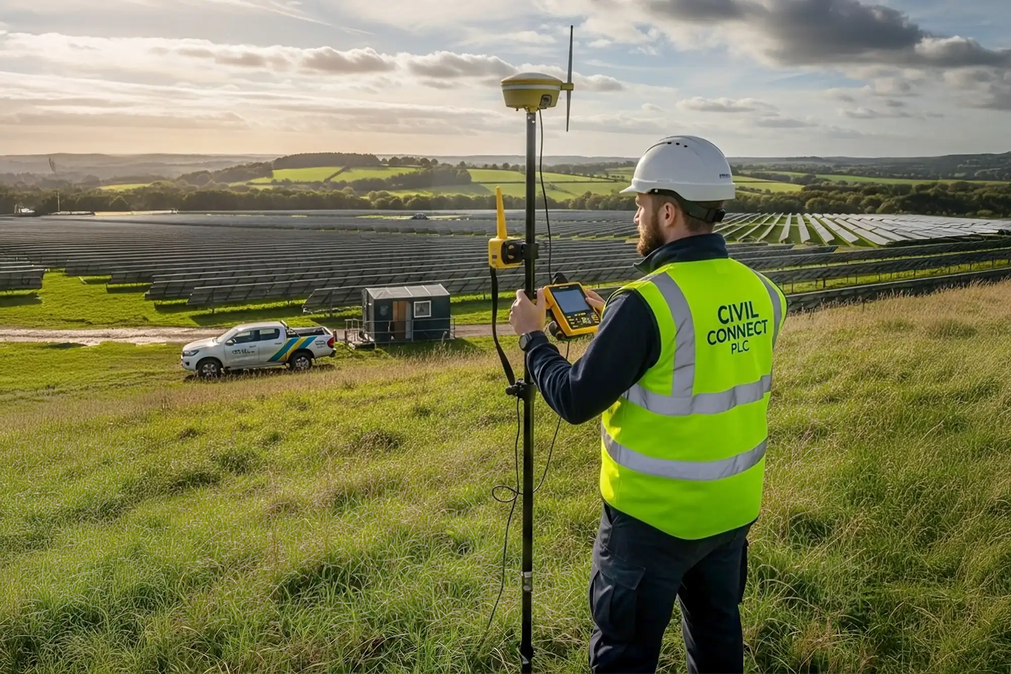
GPS & GIS Data Integration
All data collected on-site is captured using high-precision GPS/GNSS equipment. This information is then processed by our in-house technicians to produce a final, layered digital map of the subsurface infrastructure.
Our Deliverables: What You Receive
Our goal is to provide you with clear, actionable data that can be integrated directly into your project plans. Your final utility survey package will include:
PAS 128 Compliant Surveys: Delivered to the required quality level (QL-D to QL-A) to meet industry and regulatory standards.
Detailed AutoCAD Drawings: Professionally drafted 2D or 3D plans showing the horizontal and vertical alignment of all located drainage assets.
GIS Shapefiles: Data formatted for seamless integration into your existing Geographic Information System (GIS) for powerful asset management.
Manhole & Asset Condition Reports: Detailed reports on the condition, connectivity, and invert levels of manholes and other access points.
Sectors & Applications
Our drainage mapping services are critical for a range of clients and projects:
Construction & Development: For pre-design planning and clash detection on new build sites.
Local Authorities & Water Companies: For asset management and updating as-built records of public sewer networks.
Civil Engineering & Infrastructure: To safely plan excavations for new roads, bridges, and utilities.
Environmental Agencies: For mapping culverts and surface water outfalls as part of flood risk assessments.

In-House AutoCAD & Data Processing
Raw survey data is only useful when it’s transformed into a clear, actionable plan. At Civil Connect, our in-house AutoCAD team ensures that the precise data collected on-site is delivered in a format that integrates perfectly with your project’s workflow.
This dedicated service is crucial for our clients, including developers, builders, architects, and local authorities. Our capabilities include:
Data Integration: We can expertly overlay all collected utility data onto your existing AutoCAD site plans, providing a single, comprehensive view of both above-ground and subsurface infrastructure.
New Plan Creation: If you don’t have an existing plan, we can create a fully scaled and accurate AutoCAD drawing from scratch based on our comprehensive survey data.
Updating As-Built Records: We specialise in updating outdated or inaccurate as-built records, ensuring your plans reflect the true, current conditions on site, which is vital for safe and efficient asset management.
Why Partner with Civil Connect?
- Specialist Focus on Drainage: We are not generalists; our expertise lies in accurately mapping complex drainage and sewer systems.
- PAS 128 Compliant: All our surveys are conducted to the highest industry standards, giving you verifiable and trustworthy data.
- Environment Agency Registered: We are registered with the Environment Agency, ensuring all our engineers comply with the latest regulations and environmental best practices. Your project is in responsible hands.
- End-to-End Service: From the initial site scan and data collection to the final AutoCAD drawing, we manage the entire process in-house, ensuring quality and accountability.
Map the Unseen. Mitigate Your Risk.
Don’t let an unknown sewer or culvert derail your project. Contact the Civil Connect team today to discuss your site requirements and receive a detailed, no-obligation proposal.
At Civil Connect, we take pride in transforming subsurface complexity into lasting solutions. From detailed surveying to trenchless pipe repair, we expertly manage your assets to ensure they stand the test of time.
Copyright © 2025 All rights reserved. Civil Connect PLC®
Civil Connect PLC is a public limited company registered in England and Wales. Registered Number: 15368647 Registered Office: Cuckoo Wharf, Lichfield Road, Birmingham, England, B6 7SS