- Home
- About Us
- Underwater Inspection
- Reactive & Onsite Support
- Specialist Surveying
- Civils & Rehabilitation
- Trenchless Rehabilitation (UV CIPP & No-Dig)
- Specialist Culvert Cleaning & De-silting
- Manhole & Joint Rehabilitation
- Retaining Wall Maintenance & Repair
- Pothole & Pavement Repairs
- Manhole Replacement & Installation
- Gully and Catch Pit Installation
- ACO Drain Installation, Repair & Cleaning
- Sustainable Urban Drainage Systems (SUDS)
- Foul Drainage
- Highways Drainage
- Soakaway Installation
- Sectors
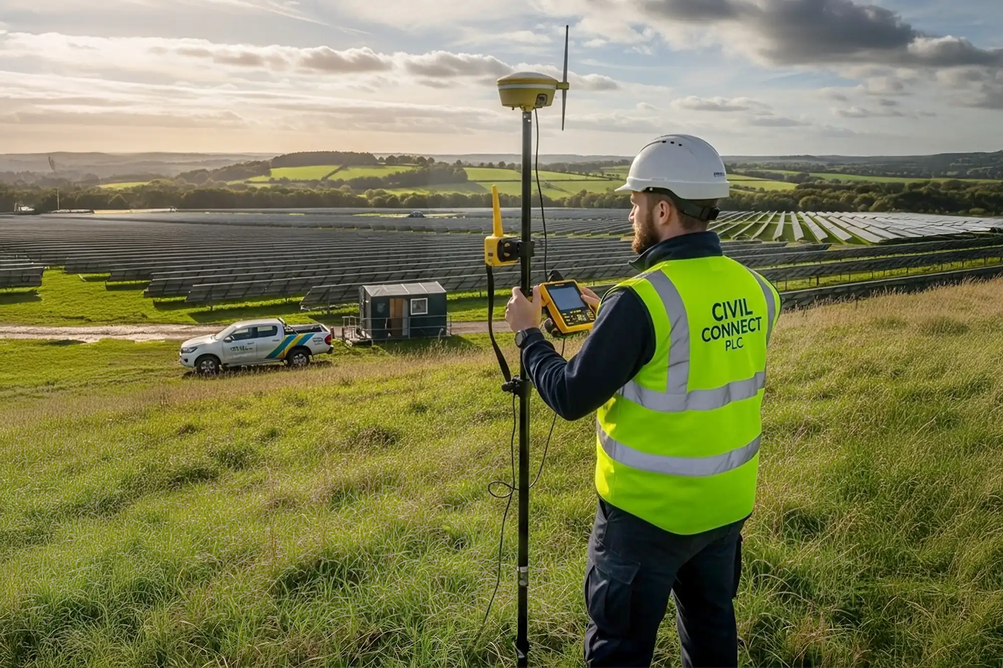
Geographical Mapping & Monitoring
- Home
- Services
- Services Detail
Mapping the Future, With Precision
We provide high-definition geospatial data and continuous monitoring to give your project clarity from the ground up. Our services transform complex landscapes into actionable, data-driven intelligence.
What is Geographical Mapping & Monitoring?
Geographical Mapping & Monitoring is the science of precisely measuring and visualizing a site’s physical characteristics. This goes beyond simple map-making; it involves using advanced technology to create detailed, multi-layered digital models of the terrain.
This service is the foundational first step for any successful development, providing a crucial understanding of land use, topography, and environmental factors, while continuous monitoring allows for the tracking of changes over time, ensuring projects stay on course.
Our Mapping & Monitoring Services
We offer a comprehensive suite of geospatial services to meet the specific demands of your project.
Topographical Surveys: We create detailed 3D maps of the ground’s surface, identifying both natural and man-made features. This is essential for accurate site planning and engineering design.
UAV (Drone) Surveys: Utilising state-of-the-art drones, we capture high-resolution aerial imagery and data quickly and safely. This is ideal for large-scale sites, inaccessible areas, and progress monitoring.
GIS Mapping & Data Analysis: We don’t just create maps; we create intelligent data systems. Our Geographic Information System (GIS) services layer multiple datasets (e.g., environmental, utility, zoning) to reveal insights, patterns, and potential constraints.
Change Detection & Monitoring: For long-term projects, we provide continuous monitoring to track changes, such as ground movement or construction progress. This service is vital for risk management and ensuring compliance throughout the project lifecycle.
Why Choose Civil Connect for Your Geospatial Needs?
Unrivalled Accuracy: Our investment in the latest survey technology, including LiDAR and high-resolution sensors, ensures the data you receive is precise, reliable, and forms a trustworthy foundation for critical decisions.
Mitigate Project Risks: By identifying potential site challenges like difficult terrain, environmental constraints, or existing infrastructure early on, our mapping services save you from costly surprises and delays.
Enhance Planning & Design: Our detailed 3D models and data sets allow architects and engineers to design with greater efficiency and accuracy, optimising layouts and ensuring seamless integration with the existing landscape.
Streamline Compliance: Our reports and surveys are prepared to the highest industry standards, providing the robust documentation required to support planning applications and demonstrate regulatory compliance.
Optimized Site & Design
Our precise 3D topographical data allows for smarter site layouts. We help you maximize usable space and optimize infrastructure placement, enhancing your project's functional design and commercial value.
Early Risk Detection
Our detailed surveys identify potential issues like difficult terrain or environmental constraints early. This allows you to mitigate risks before they become costly problems during the project lifecycle.
Streamlined Approvals
Our survey reports provide the robust, accurate documentation required to support planning applications, helping to accelerate the approval process and keep your project on schedule.
Data-Driven Decisions
Our multi-layered GIS maps and 3D models provide a complete understanding of your site, empowering your team to make smarter, more informed strategic decisions from the very start of your project.
Get the Complete Picture of Your Project
Ready to build on a foundation of certainty? Contact our team today to discuss how our Geographical Mapping & Monitoring services can bring clarity and precision to your project.
At Civil Connect, we take pride in transforming subsurface complexity into lasting solutions. From detailed surveying to trenchless pipe repair, we expertly manage your assets to ensure they stand the test of time.
Copyright © 2025 All rights reserved. Civil Connect PLC®
Civil Connect PLC is a public limited company registered in England and Wales. Registered Number: 15368647 Registered Office: Cuckoo Wharf, Lichfield Road, Birmingham, England, B6 7SS