- Home
- About Us
- Underwater Inspection
- Reactive & Onsite Support
- Specialist Surveying
- Civils & Rehabilitation
- Trenchless Rehabilitation (UV CIPP & No-Dig)
- Specialist Culvert Cleaning & De-silting
- Manhole & Joint Rehabilitation
- Retaining Wall Maintenance & Repair
- Pothole & Pavement Repairs
- Manhole Replacement & Installation
- Gully and Catch Pit Installation
- ACO Drain Installation, Repair & Cleaning
- Sustainable Urban Drainage Systems (SUDS)
- Foul Drainage
- Highways Drainage
- Soakaway Installation
- Sectors
- Home
- Services
- 3D Mapping
3D Mapping
Need Accurate 3D Mappings Of Your Infrastructure?
3D Mapping for Sewers and Water Infrastructure Nationwide
Our 3D Mapping services deliver highly accurate and detailed representations of sites and structures, using cutting-edge laser scanning and photogrammetry technology. These maps provide valuable data for planning, design, and analysis across construction, drainage, and infrastructure projects. Ideal for complex environments, this service ensures precision, efficiency, and informed decision-making.
What is an Environmental Risk Assessment?
we are proud to introduce our latest cutting-edge service: 3D Mapping for Drain Sewers and Water Infrastructure. Leveraging advanced technology and innovative techniques, this service enables comprehensive, accurate, and efficient mapping of underground systems to support both maintenance and future planning needs.
Why Choose 3D Mapping for Drains & Water Infrastructure?
Understanding what’s beneath the surface is critical for the effective management of drainage networks, sewer systems, and water infrastructure. Traditional methods often fall short in providing the level of detail and precision required for modern project demands.
Our 3D Mapping service offers:
- Enhanced Accuracy: Gain a precise and detailed view of underground infrastructure.
- Time Efficiency: Reduce project timelines with rapid data capture and interpretation.
- Improved Maintenance: Quickly identify faults, blockages, or areas requiring attention.
- Proactive Planning: Make informed decisions for repairs, upgrades, and future works.
Whether you’re dealing with a complex sewer network, a water main upgrade, or routine infrastructure inspections, our 3D mapping solutions are designed to deliver unmatched insights.
How Does 3D Pipeline Mapping Work?
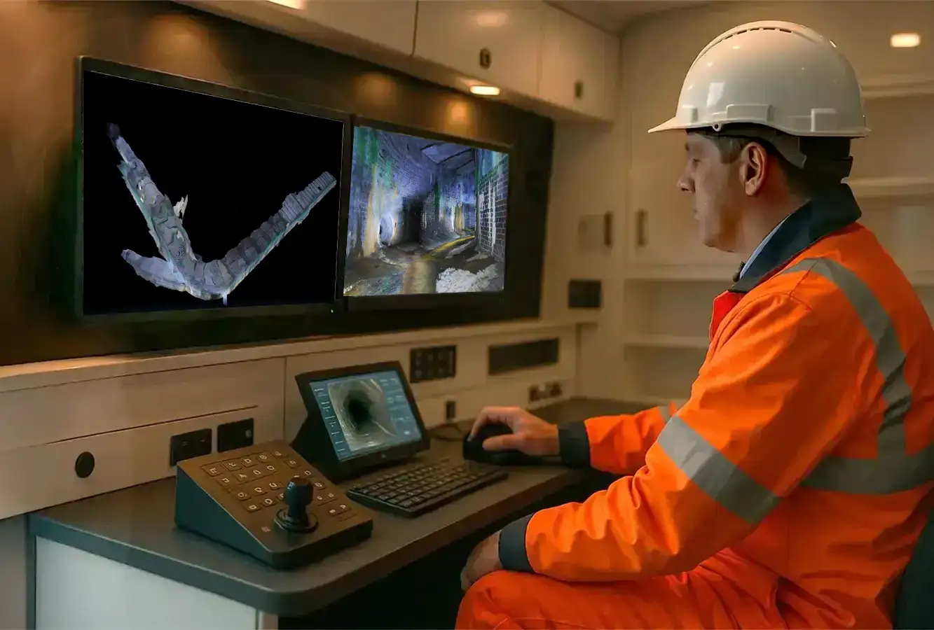
Our service uses state-of-the-art LiDAR technology and high-resolution imaging equipment to scan and collect data from underground systems. This data is then processed to create highly detailed 3D models of your sewer and water infrastructure. These models provide a clear, visual representation of the system, including pipe alignments, flow paths, obstruction points, and other critical details.
The process includes:
- Pre-survey Analysis: Identifying points of interest and planning the mapping process.
- Data Collection: Using advanced scanning tools to survey and capture underground assets.
- 3D Model Creation: Transforming raw data into accurate, interactive 3D models.
- Analysis & Reporting: Providing actionable insights and recommendations based on the findings.
Tailored 3D Map Solutions for Every Project
We provide comprehensive 3D Pipeline mapping services to assess the condition and layout of your private, public, and sewer drainage assets. Our advanced mapping technology delivers essential insights, including precise pipeline locations, depths, and structural integrity.
For effective flood prevention, our expert engineers create detailed 3D models and tailored reports, offering accurate diagnoses and empowering you to make informed, data-driven decisions.
Applications of Our 3D Mapping Service
Civil Connect 3D Pipeline Inspection expertise benefits a wide range of industries and applications, including:
- Drainage System Assessment: Spot blockages, collapses, and alignment issues with pinpoint precision.
- Sewer Network Design: Plan and design new sewer systems with confidence, backed by accurate data.
- Maintenance Planning: Prioritise areas that need immediate attention and predict future issues.
- Water Supply Infrastructure: Map and maintain pipelines, reducing risks of leaks or bursts.
- Urban Development Projects: Ensure underground systems align with construction and expansion plans.
Key Benefits of 3D Mapping Service
- Why partner with Civil Connect for your 3D mapping needs?
- Advanced Technology: We employ the latest equipment and software for unparalleled results.
- Experienced Team: Our engineers and technicians bring years of expertise to every project.
- Customised Solutions: Tailored mapping services to meet your specific project requirements.
- Cost-Effectiveness: Reduce risks and costly errors with precise mapping and reliable data.
- Commitment to Sustainability: Our efficient processes minimise environmental impact by enabling smarter planning and reduced excavation work.
Let’s Get Started
Civil Connect, we’re committed to helping you manage and maintain your underground infrastructure with greater confidence and clarity. Our 3D Mapping for Drain Sewers and Water Infrastructure service offers the perfect combination of advanced technology, industry expertise, and customised solutions to suit your needs.
To learn more about our 3D mapping services or to discuss your project requirements, contact us today!
At Civil Connect, we take pride in transforming subsurface complexity into lasting solutions. From detailed surveying to trenchless pipe repair, we expertly manage your assets to ensure they stand the test of time.
Copyright © 2025 All rights reserved. Civil Connect PLC®
Civil Connect PLC is a public limited company registered in England and Wales. Registered Number: 15368647 Registered Office: Cuckoo Wharf, Lichfield Road, Birmingham, England, B6 7SS